About the Shire
Welcome to the Shire of Northam
Just over an hour from Perth through the Great Eastern Highway, Northam is the perfect base for exploring the scenic Avon Valley.
Have a walk through town and admire its architecture, along the way, you’ll find great craft shops options, and plenty of places to pause for coffee, alfresco lunches, and dining experiences.
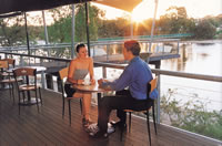
The Avon River winds gently through the Shire of Northam, an ideal setting for a riverside picnic. Keep an eye out for the white swans that have called the river home for over a century, or take in the view from the iconic pedestrian suspension bridge that crosses the water.
Looking for adventure? Northam has you covered. Try your hand at hot air ballooning, horse riding, or hiking.
Want to learn more about the area? Check our visitors webpage or stop by our visitor centre.
Here's a quick snapshot of the Shire of Northam.
| SHIRE OF NORTHAM AREA |
1,432km2 |
| SHIRE OF NORTHAM GAZETTED |
1836 |
| ESTIMATED RESIDENTIAL POPULATION (2024) |
12,416 |
| COUNCIL COMPOSITION |
8 Councillors, 1 President |
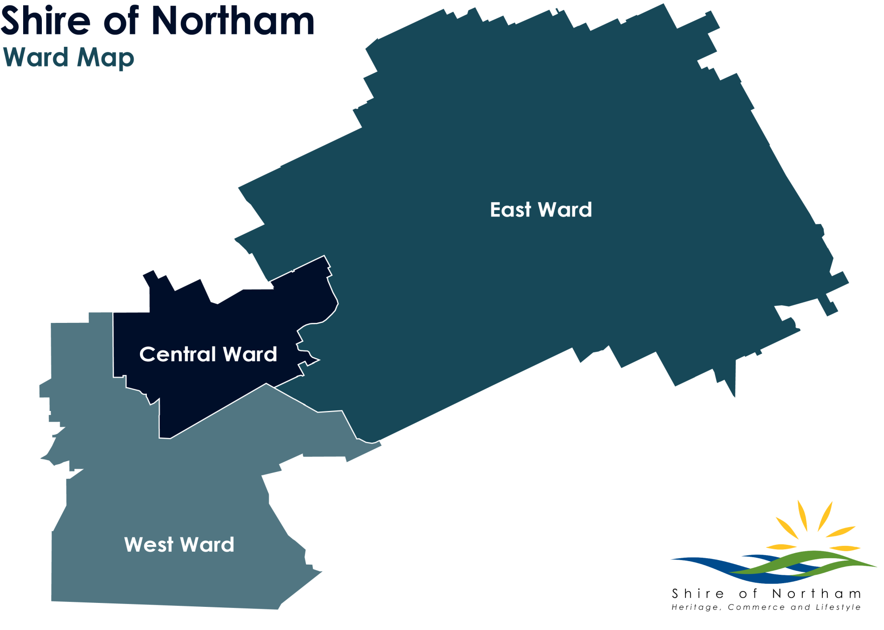
| WARD STRUCTURE |
3 wards - West, East and Central |
Some Statistics
The Shire of Northam has invested in the development of community and economic profiling tools to help build a greater understanding of the community and economy to attract and direct funding and other support to areas most needed in the community.
Chief Executive Officer Jason Whiteaker said “Access to a rich source of local demographic and economic data gives Council an insight and a framework to make confident, strategic and informed decisions about how to best support the community.”
“The data analysis highlights the changing dynamics in the local economy, and this helps Council to identify potential challenges and generate opportunities to influence growth.”
The Shire commissioned ID Consultants to collate local data to create detailed local area profiles. The tools will be available to the public as a shared resource for the community and can be used as a reliable evidence base to strengthen their external submissions and applications.
The community and economic profiling tools can be accessed by following the links below.
http://profile.id.com.au/northam
http://atlas.id.com.au/northam
http://economy.id.com.au/northam
Some History
Northam is the regional service centre of the Avon Valley and Central Wheatbelt. Farming communities (which primarily produce wheat, barley, oats, sheep, wool and cattle) use Northam for their everyday banking, retail, shopping and government servicing requirements.
The town has been established by the State Government as a regional centre, resulting in many government departments maintaining a strong presence.
The Northam townsite was first gazetted in 1836 and is the focal point for important rail and road links to Eastern Australia. It was a centre for Post-War migration and many of the residents have strong links to Eastern Europe. The Mundaring to Kalgoorlie pipeline passes through Northam, and the townsite has a significant number of heritage buildings.
History of Place Names
Other localities within the Shire of Northam include Bakers Hill, Clackline, Grass Valley, Spencers Brook, Seabrook and Wundowie, and more information on these towns and exploring the Shire of Northam can be found on the Towns section of this website.
Discover the origins of some of these localities names that make up the great Shire of Northam.
Bakers Hill
Originally known as Mount Baker, the name was changed in 1902 to avoid confusion with Mount Barker. It is believed to be named after early settler John (or James) Baker. In 1944, the apostrophe in Baker’s Hill was officially dropped, resulting in the name we use today.
Clackline
Clackline is a small rural locality with a rich railway and industrial past. Established in the 1880s, it became a key junction for the Eastern Railway lines to Northam and Toodyay. Despite its railway history, the origin of the name “Clackline” remains a mystery, an interesting and charming touch to a place full of local character.
Grass Valley
Just east of Northam lies Grass Valley, a small township named after a local farm established in 1833 by settler William Nairn. The name reflects the area's early agricultural roots and rich landscape.
Northam
Northam was named by Governor James Stirling, likely after a town of the same name in Devon, England. In tribute, you’ll find Stirling Street in the heart of town today. Northam holds a proud place in WA’s political history, it has produced five State Premiers and many notable political figures.
Spencers Brook
Spencers Brook began as a land grant to Spencer Trimmer in 1838, later sold to T.R.C. Walters and eventually to Thomas Wilding in 1874. Originally considered for names like New York and Brookton, the area ultimately took the name of the railway siding, Spencers Brook. By 1895, the siding grew into a major railway junction linking Perth-Kalgoorlie and Beverley-Albany lines. It played a key role in transportation until 1966. At its peak, Spencers Brook featured a hotel, racecourse, grain depot, dairy, brickworks, and a WWII supply depot. Street names like Thomas, Rose, Robinson, Fraser, Forrest and Cowan reflect both family names and early WA officials.
Wundowie
Wundowie takes its name from nearby Woondowing Spring. The word is believed to originate from the Aboriginal term Ngwundow, meaning “to lie down.” The town was purpose-built in the 1940s following the government's decision to establish a blast furnace and wood distillation plant. Land was surveyed in 1946 and the town was officially gazetted in 1947.